
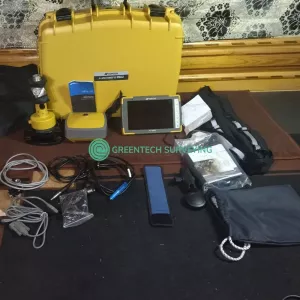
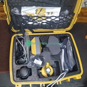

Description
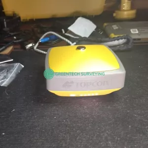
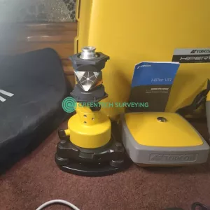
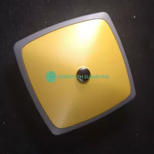
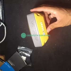
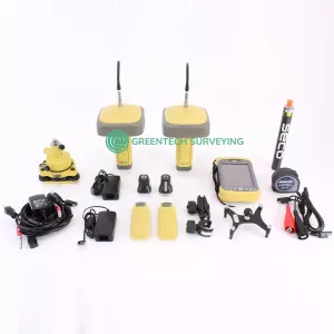
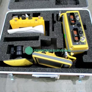
Up for sale Topcon Hiper VR for Rover or Base. Used but in very good condition working fine coming with all accessories show on the pictures. Comes with a 30-day money back guarantee.
Package includes:
- Topcon HiPer VR Base or Rover
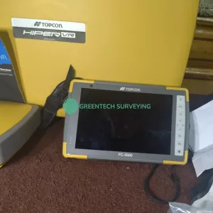
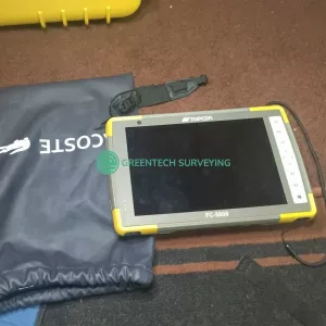
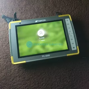
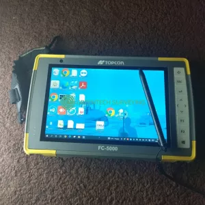
- Topcon FC-5000 Data Collector
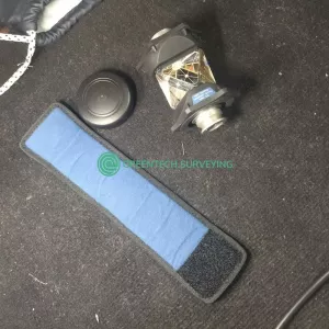
- Topcon ATP1 360° Prism with Protective Cover
- Removable Cap for Topcon ATP1 Prism
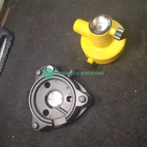
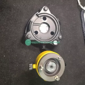
- 1x Tribrach with Optical Plummet Adapter
- Soft bag
- Hard Case
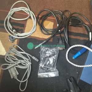
- Cables
- 30-day money back guarantee
The HiPer VR is versatile and rugged, designed with the advanced GNSS technology delivering precise measurements in the most challenging of environments.
Topcon patented Universal Tracking Channels™ technology provides the industry’s most efficient approach in identifying and using every satellite signal.
All constellation signals are tracked automatically from any available channel.
Thus, reaching maximum performance with a reduced number of channels.
Made versatile and rugged enough to deliver precise measurements in the most challenging of environments.
- Signal scrubbing Fence Antenna® to provide ultimate signal lock
- Highest accuracy positioning for RTK, network, and more
- Multiple communication configurations for your various project scenarios
- LongLink™ interference-free communication, up to 300 m range
TILT™
The HiPer VR incorporates a revolutionary 9-axis Inertial Measuring Unit (IMU) and an ultra-compact 3-axis eCompass.
Topcon Integrated Leveling Technology compensates for mis-leveled field measurements out of plumb by as much as 15°.
- Compact, lightweight, rugged design
- Field tested, field ready IP67 design
- Compact form factor ideal for Hybrid Positioning
- Revolutionary 9-axis IMU and ultra-compact 3-axis eCompass
HIPER VR Specifications
| GNSS TECHNOLOGIES (SIGNAL TRACKING) | |
| Tracking Channels | 226 GNSS channels Vanguard Technology™ with Universal Tracking Channels™; 2 reserved for L-band |
| L-band | Yes |
| TILT | Topcon Integrated Leveling Technology |
| GNSS Antenna | Integrated Full wave Fence Antenna™️ technology with internal ground plane |
| GPS | L1 C/A, L1C, L1P(Y), L2P(Y), L2C, L5 |
| GLONASS | L1 C/A, L1P, L2C/A, L2P, L3C |
| Galileo | E1, E5a, E5b, E5 Alt-BOC |
| BeiDou | B1, B2 |
| IRNSS (NavIC) | SPS-L5 |
| SBAS | WAAS/EGNOS/MSAS |
| QZSS | L1 C/A, L1C, L2C, L5 |
| POSITIONING PERFORMANCE | |
| Precision Static | Horizontal accuracy: 3 mm + 0.1 ppm |
| Vertical accuracy: 3.5 mm + 0.4 ppm | |
| Static/Fast Static | Horizontal accuracy: 3 mm + 0.4 ppm |
| Vertical accuracy: 5 mm + 0.5 ppm | |
| RTK | Horizontal accuracy: 5 mm + 0.5 ppm |
| Vertical accuracy: 10 mm + 0.8 ppm | |
| Code Differential GNSS | Horizontal accuracy: <0.25 m |
| Vertical accuracy: <0.50 m | |
| RTK, TILT Compensated | Horizontal accuracy: 1.3 mm/°Tilt; Tilt ≤ 10° |
| Vertical accuracy: 1.8 mm/°Tilt; Tilt > 10° | |
| COMMUNICATIONS | |
| Internal Radio (Optional) | 405–470 MHz UHF or FH915 spread spectrum |
| Max Transmit Power: 1W | |
| Range: 5–7 km typical; 15 km in optimal conditions. | |
| Cellular | Optional 4G internal cellular module |
| LongLink | Up to 328.1 m / 1000 ft |
| Bluetooth | Yes |
| Ports | 1 Serial, 1 USB, 3 Connectors |
| DATA FORMAT AND MEMORY | |
| Data Output | TPS, RTCM, CMR/CMR+, NMEA, BINEX |
| Internal Memory | 8 GB |
| Update Rate | Up to 20Hz |
| POWER | |
| External Power Supply | 9.0 – 27.0 V DC |
| Battery | Li-ion 11,600 mAh, 3.7 V |
| Operating time with radio | RX mode – 10 hr | TX mode 1W – 6 hr |
| Use of external 12V battery is recommended when using as a base | |
| HARDWARE | |
| Dimensions (W x H) | 14.90 x 9.46 cm (5.86 x 3.72 in) |
| Weight | 1.061 kg (2.33 lb) |
| Ingress Protection | Dust and water IP67 |
| Vibration | MIL-STD 810G |
| Drop | Survive 2m pole drop on concrete surface |
| Operating Temperature | -40° C to +65° C (-40° F to +149° F) |
| Humidity | 100% |