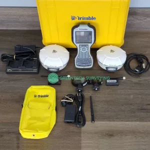
Description
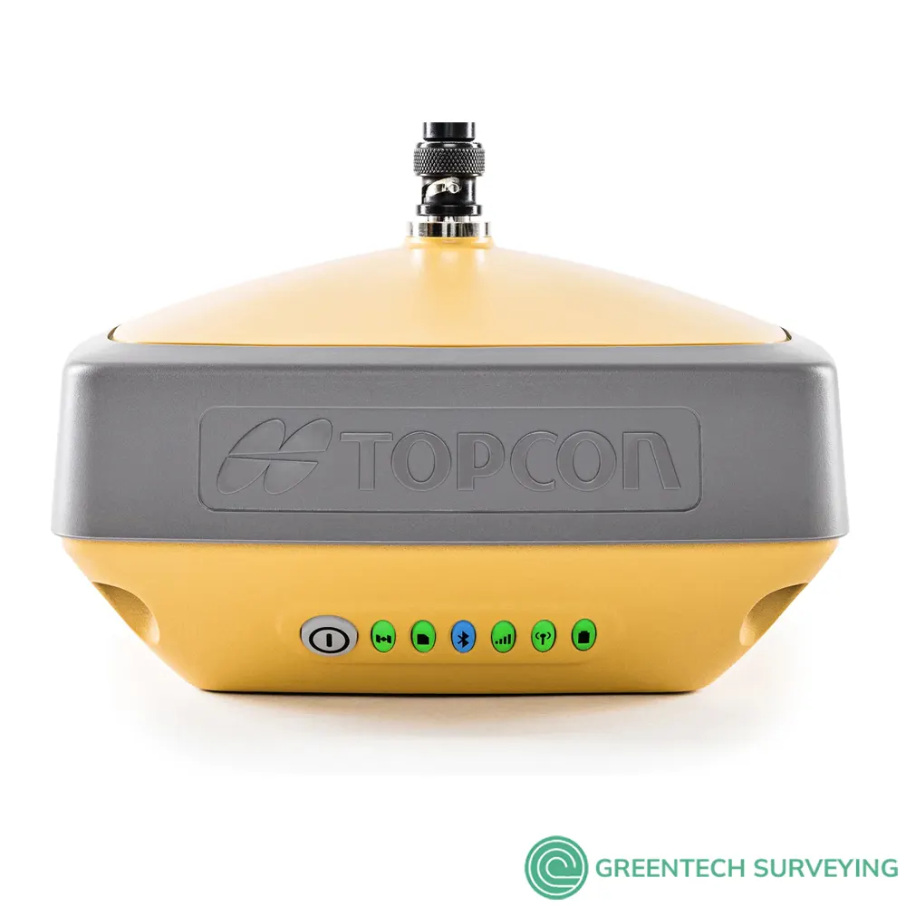
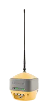
Topcon HiPer VR GNSS Receiver for sale, compact, light and packed with the most advanced GNSS technology in a design built to withstand the harshest field environments. Using Topcon’s advanced GNSS chipset with Universal Tracking Channels Technology, the HiPer VR automatically tracks every satellite signal above – now and into the future.
All signals, all satellites and all constellations — in a compact, rugged design, with an integrated IMU and eCompass.
The HiPer VR is a complete solution and versatile in many ways. It can be used for static or kinematic GNSS post-processed surveys, as a network RTK rover with the FC-5000's internal 4G/LTE cellular modem, as a UHF/FH/Longlink jobsite RTK rover, and also in Topcon’s patented Hybrid Positioning workflow.
HiPer VR Is Perfect For Field Surveying, Site Work, OEM
Top features include:
- Universal tracking technology for all satellites and constellations (GPS, GLONASS, Galileo, Beidou, IRNSS, QZSS, SBAS) covering all modernised signals
- Field tested, field ready IP67 design
- Compact form factor ideal for Millimeter GPS and Hybrid Positioning
- Revolutionary 9-axis IMU and ultra-compact 3-axis eCompass
- Integrated 400 MHz UHF Tx/Rx Radio Modem
- Integrated License free 900 MHz Radio Modem, FH915 protocol
Better form and function: The HiPer VR is versatile and rugged, designed with the most advanced GNSS technology delivering precise measurements in the most challenging of environments. Topcon patented Universal Tracking Channels technology provides the industry’s most efficient approach in identifying and using every satellite signal. All constellation signals are tracked automatically from any available channel. Thus, reaching maximum performance with a reduced number of channels.
Easy to learn and use, this versatile solution with signal scrubbing Fence Antenna provides ultimate signal lock, high-accuracy RTK positioning, multiple communication configurations and LongLink interference-free communication that will help complete your work with precision and speed.
- Universal Tracking Channels for all satellites, signals and constellations
- Field-tested, field-ready IP67 design
- Compact form ideal for Millimeter GPS and Hybrid Positioning
- Revolutionary 9-axis IMU and ultra-compact 3-axis eCompass
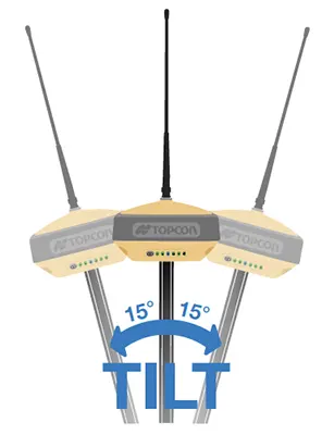 TILT – Topcon Integrated Leveling Technology
The HiPer VR incorporates a revolutionary 9-axis inertial measurement unit (IMU) and an ultra-compact 3-axis eCompass. This advanced technology compensates for mis-leveled and out of plumb field measurements by as much as 15 degrees.
Awkward shots on steep slopes or hard to reach spots are now a breeze with TILT.
- Compact, lightweight, rugged design
- Field tested, field ready IP67 design
- Compact form factor ideal for Hybrid Positioning
- Revolutionary 9-axis IMU and ultra-compact 3-axis eCompass
Integrated radio and modem options
• 400 MHz UHF Tx/Rx radio
• License-free 900 MHz radio, FH915 protocol
L Band-ready technology
The HiPer VR is L Band-ready for countless advantages in receiving advanced GNSS corrections globally.
Highly configurable
Designed to grow with you, unique electronic option files empower you to activate available features instantly
Future proof
Topcon Universal Tracking Channels technology tracks all GNSS signals currently available and is designed to track the constellations and signals of tomorrow
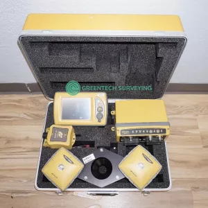
Most common setups for the HiPer VR kits:
- Base and Rover UhF - One of the most popular setups for people looking to use UHF radio connectivity between the base and rover. This will provide a range of about 3 miles through the UHF Radio. Make sure you choose the correct radio frequency.
- Base and Rover 915+ - This is setup the go to setup for 2D and 3D machine control systems. These HiPer VRs use a special 915 radio frequency to provide a range of 1 mile connectivity between the base and rover.
- HiPer VR Network Rover - If you plan on piggy backing off an existing base station network using your cellphone, this is the option for you. It's half the cost, you don't have to worry about someone stealing your base station, and you can use your cellphone. You MUST check with your local states to look for public and private networks. The one downfall here is if you don't have good cellphone service, this isn't going to work.
- Single Bases - These are if you need to replace a base station. Make sure you get the correct radio frequency for your job application.
| HIPER VR TECHNICAL SPECIFICATIONS | |
| GNSS Tracking | |
| Channel Count | 226 with Topcon’s patented Universal Tracking Channels technology. |
| Signal | |
| GPS Signals | L1 C/A, L1C† L2C, L2P(Y), L5 L1C when signal available. |
| GLONASS | L1 C/A, L1P, L2C/A, L2P, L3C L3C when signal available |
| Galileo | E1/E5a/E5b/Alt-BOC |
| BeiDou/BDS | B1, B2 |
| IRNSS | L5 |
| SBAS | WAAS, EGNOS, MSAS, GAGAN (L1/L5) L5 when signal available. |
| L-band | TopNET Global D & C Corrections services |
| QZSS | L1 C/A, L1C, L1-SAIF, L2C, L5 |
| Positioning Performance | |
| Static/Fast Static | H: 3 mm + 0.4 ppm V: 5 mm + 0.5 ppm |
| RTK | H: 5 mm + 0.5 ppm V: 10 mm + 0.8 ppm |
| RTK, TILT Compensated |
H: 1.3 mm/°Tilt; Tilt ≤ 10° V: 1.8 mm/°Tilt; Tilt > 10° Maximum recommended angle for tilt compensation is 15° |
| DGPS | 0.25 m HRMS |
| L-Band, D Corrections Service |
H: < 0.1 m (95%) V: < 0.2 m (95%) |
| Operational Time |
RX mode - 10hr TX mode 1W - 6hr Use of external 12V battery is recommended when using HiPer VR with internal radio in transmit mode. |
| Internal Radios | 425-470 MHz UHF radio Max Transmit Power: 1W Range: 5-7 km typical; 15 km in optimal conditions. |
| Memory | Internal Non-removable 8 GB SDHC |
| Environmental | Ingress Rating – IP67 Operating Temp – -40ºC to 70ºC Humidity – 100%, condensing Drop and Topple – 1.0 m drop to concrete. 2.0 m pole drop to concrete. |
| Dimensions | 150 x 100 x 150 mm (w x h x d) |
| Weight | <1.15 kg |
| TOPCON HIPER HR, HIPER VR AND HIPER SR GNSS RECEIVERS COMPARATION | ||
 |
 |
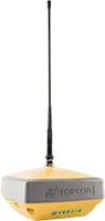 |
| Topcon HiPer HR GNSS Receiver | Topcon HiPer VR GNSSS Receiver | Topcon HiPer SR GNSS Receiver |
| Receiver with integrated antenna and radio | Receiver with integrated antenna and radio | Receiver with integrated antenna |
| Description | Description | Description |
| Measurement, layout, field survey, grade checking, base or rover, Hybrid positioning ,TILT, network caster | Measurement, layout, field survey, grade checking, base or rover, Hybrid positioning, TILT | Measurement, layout, field survey, grade checking, base or rover, Hybrid positioning |
| Ideal Use | Ideal Use | Ideal Use |
|
GPS |
GPS GLONASS BeiDou Galileo SBAS QZSS IRNSS |
GPS GLONASS |
| Constellations tracked | Constellations tracked | Constellations tracked |
| UHF radio FH915+ spread spectrum radio LongLink Bluetooth 4G Cell (Europe) WI-FI L-band |
UHF radio FH915+ spread spectrum radio LongLink Bluetooth 4G Cell (Europe) L-band |
LongLink Bluetooth |
| Communications for corrections (availability varies by region) | Communications for corrections (availability varies by region) | Communications for corrections (availability varies by region) |
| Yes | Yes | Yes |
| Hybrid Positioning | Hybrid Positioning | Hybrid Positioning |
| Hot-swappable battery | Double-internal batteries | Internal battery |
| Battery | Battery | Battery |
| -40°C to 65°C | 40°C to 65°C | -40°C to 65°C |
| Operating temperature | Operating temperature | Operating temperature |
| IP67 | IP67 | IP67 |
| Dust and water resistance | Dust and water resistance | Dust and water resistance |
| 115 mm x 115 mm x 132 mm | 115 mm x 115 mm x 132 mm | 115 mm x 115 mm x 132 mm |
| Dimensions | Dimensions | Dimensions |
| 925 g | 925 g | 850 g |
| Weight | Weight | Weight |
Documentation